Showing posts with label blog. Show all posts

Tuesday, October 4, 2011

Google Lat Long Blog: Getting From ‘here To There’ With My Location In Google Maps

When getting directions on Google Maps, we suggest an origin or destination after you type the first few characters. But, we want to save you even more time by eliminating the need to type your current address each time. Today you can start using ‘My Location’ as a starting or ending point for your directions using the familiar ‘blue dot’ found in Google Maps for mobile.

lue lisää


Google Lat Long Blog: Getting from ‘Here to there’ with My Location in Google Maps


Backlink: http://feedproxy.google.com/~r/blogspot/SbSV/~3/J9rkh2V9RqE/getting-from-here-to-there-with-my.html
None

Saturday, October 1, 2011

Google Geo Developers Blog: 5 Great Maps... That Are Just Great!

Each month I try to focus on 5 great maps within a certain theme, but this month Google Geo developers have really outdone themselves and I’ve been blown away by a flurry of great new Maps API applications across the board. I’ve been especially impressed by the new uses I’ve seen of Styled Maps, Fusion Tables, and our new Places API.

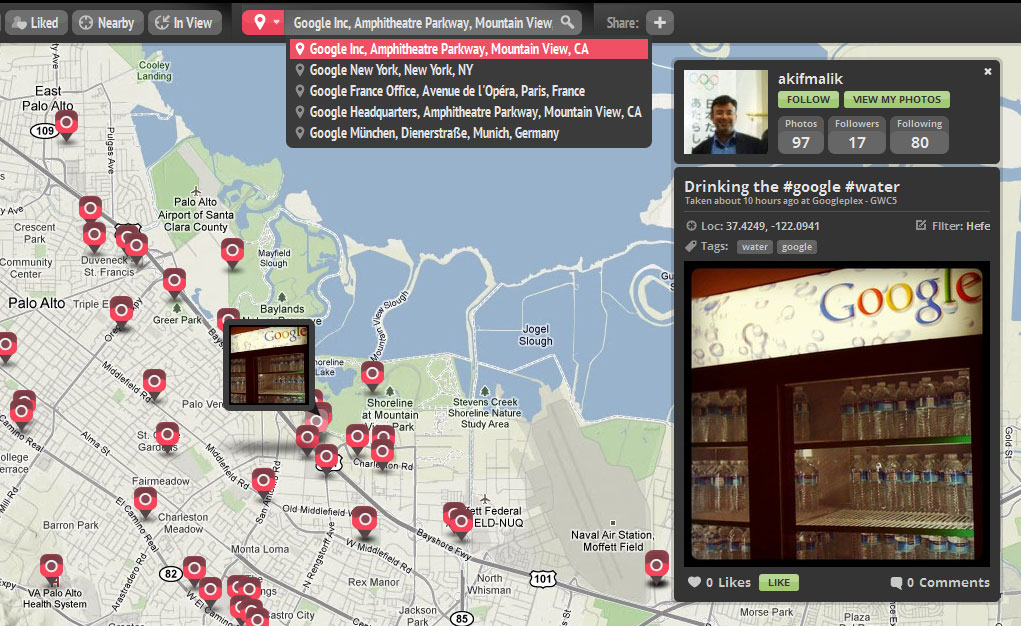
InstaEarth

Instagram is an exciting photography tool, but what really takes Instagram to the next level are applications like InstaEarth from Modea. InstaEarth is an easy way to search for and discover Instragram users and photos on a map. The application makes use of the Places API with Autocomplete to help users to search around a landmark or address. From InstaEarth, “InstaEarth is a way to discover and view beautiful Instagram photography taken around the world. View your feed, friends' feeds, popular photos, or navigate the map and explore the world through the eyes of Instagrammers everywhere.”

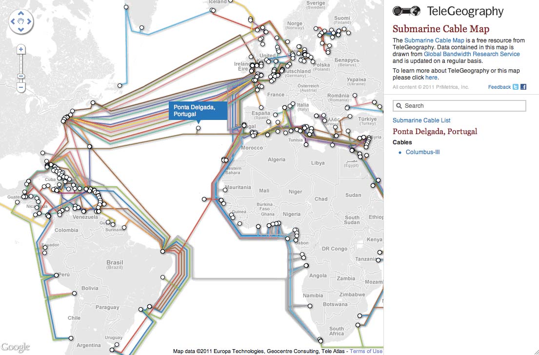
TeleGeography - Submarine Cable Map

When you make a phone call or send an email abroad, most of the time that data travels by way of submarine cables. Submarine cables are the backbone of the global economy, so it’s fascinating to spend time exploring a map that shows where these cables are located. In addition to being a really interesting, fun, and a great looking map, this map is also technically savvy application. Each line representing a submarine cable is clickable and when selected grays out the other cables for better visibility. The map also uses Styled Maps to help the cables stand out better and Fusion Tables to help manage the data on the back-end.

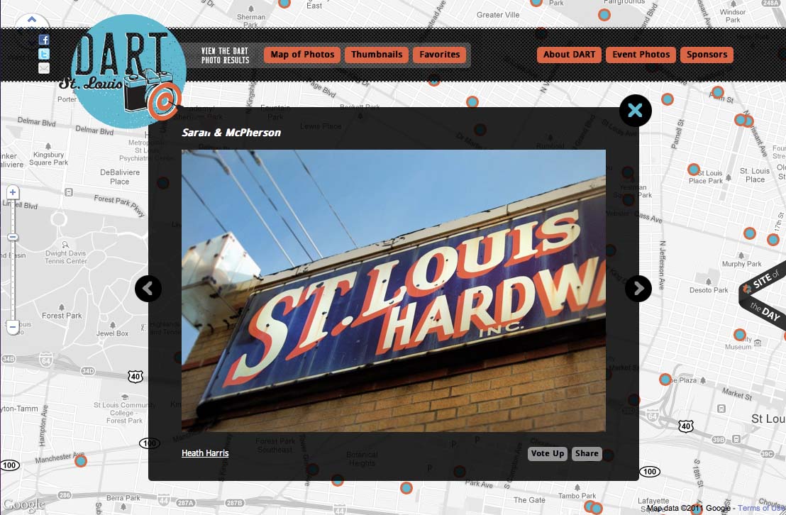
DART St. Louis

There are two things I love to geek out on: maps and photography. That’s why I love this map from DART St. Louis. From their website, “In April 2011 over 250 creative St. Louisans gathered to throw darts at a huge map of the City of St. Louis. Participants then had one month to visit the area where their dart landed and make a photograph. The resulting collection of photographs shows a snapshot of St. Louis as it is today, one random block at a time.”

Berliner Morgenpost - Berlin Elections Map

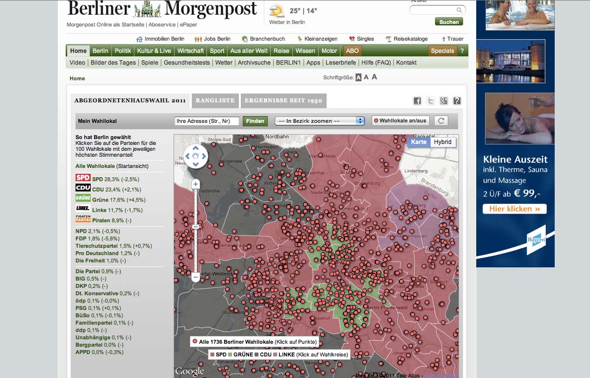
Last month I wrote a post about a 5 Great Maps from Germany and this month we have yet another great map from Germany. Using Fusion Tables, Berliner Morgenpost mapped out the results of the September 2011 Berlin elections. Voting districts are colored coded by which political party received the majority of votes. Additionally, you can click on any one of the voting districts which will display an infowindow with a chart of the full voting results. This an excellent example of Google Maps API supporting the democratic process and bringing better transparency to government.

Dodge Journey Search

To promote the new Dodge Journey, Dodge is running a competition on YouTube where users can win one of three brand new Dodge Journeys. Video clues are released on YouTube to help users track down the secret location of the vehicle and if they find it, they own it. The clues are related to places in the real world, so users can rely on Google Maps and Places to help them figure out where the car is located. The Maps API serves as the hub of information for this competition and uses Styled Maps to match Dodge branding along with the Places API with Autocomplete to help users follow up on clues.


Google Geo Developers Blog: 5 Great Maps... That are just great!


Backlink: http://feedproxy.google.com/~r/GoogleGeoDevelopersBlog/~3/PsS7gQ7wtwc/5-great-maps-that-are-just-great.html


None

Wednesday, September 21, 2011

Google Geo Developers Blog: Quick And Simple Street View With The Google Street View Image Api

The Google Maps API family includes the Google Static Maps API, which delivers maps as fixed images in PNG, GIF, or JPG format. It’s great when you want to quickly add a map to a page without writing a JavaScript application, when you need maps on a device with no JavaScript support, or for generating lightweight thumbnail maps or maps for printing. In fact we’re so delighted with the popularity of the Static Maps API that today we’re launching an accompanying service for Street View imagery.

The Google Street View Image API brings the simplicity of the Static Maps API to Street View, providing a way to add a Street View image or thumbnail to any application without the need for JavaScript. Simply construct a URL in accordance with the documentation, and the API returns the corresponding Street View panorama as an image in JPG format:


You can use the Street View Image API in both web based and mobile apps, and the size limits and daily quotas match those of the Static Maps API for both the consumer Maps API and Maps API Premier. You can display Street View images in your apps using this API without a corresponding Google map, but if you do choose to display a map it must be provided by Google. For more details on how to use the Street View Image API please refer to the documentation.

To make it easier to find help using the Street View Image API and Static Maps API, we’re also launching a new forum today dedicated to these services. If you have any questions regarding use of these APIs going forward we recommend you head over to the new Google Maps Image APIs group. We look forward to seeing you there!


Google Geo Developers Blog: Quick and simple Street View with the Google Street View Image API


Backlink: http://feedproxy.google.com/~r/GoogleGeoDevelopersBlog/~3/-of_tocmBuI/quick-and-simple-street-view-with.html


None

Wednesday, July 27, 2011

Here's What The First Blog, Smartphone, and Web Browser Looked Like


justin

Someone had to send the first email. Someone had to create the first computer virus. And obviously, someone had to register the first internet domain.

It's only because of so many technical visionaries that we have the Internet as we know it today.

Here are some of the humble first steps that got us here.

First mobile phone with Internet access: Nokia 9000 Communicator

Available in Finland in 1996, the Nokia 9000 Communicator was almost non-viable due to extremely high costs to the service providers.

In 1999, a much more practical Internet device called the i-Mode launched in Japan, but it wasn't the first.


First email: nonsense letters

Ray Tomlinson sent the first email in late 1972 between two computers sitting right next to each other. He doesn't remember what it said, but he speculates that it was just "QWERTYUIOP."


The first blog: Justin's Links To The Underground

Justin Hall is widely credited with starting the first blog in 1994 while a student at Swarthmore College. It's still active today, with a full archive.


See the rest of the story at Business Insider

Please follow SAI: Tools on Twitter and Facebook.

See Also:


Here's What The First Blog, Smartphone, and Web Browser Looked Like


Backlink: http://feedproxy.google.com/~r/typepad/alleyinsider/silicon_alley_insider/~3/Hp-8ILGMQy4/technology-and-internet-firsts-2011-7

Wednesday, June 29, 2011

Google Lat Long Blog: Street View: Our biggest update yet

Wednesday, June 29, 2011 at 10:25 AM

Since we launched Street View on Google Maps in the U.S. in 2007 we’ve added 26 more countries and enabled you to explore images across all seven continents. Today we’re excited to share with you the latest expansion of Street View because it’s our biggest update yet.

New imagery is now available for 13 of our established Street View countries: Denmark, Ireland, Italy, Spain, Netherlands, Norway, Sweden, Romania, South Africa, Taiwan, Japan, the United States, and the United Kingdom.

I like wine so I’m particularly interested in seeing the new imagery around Italy’s famous Chianti region and other beautiful areas of Tuscany. Across the mediterranean in Spain, the home of another renowned wine is available with the addition of the Rioja province.

Pechina, Rioja Region, Spain

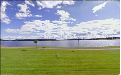
And as a food lover I’m keen on discovering Denmark’s beautiful chain of Smålands Islands - famous for its fruits that have inspired many Danish chefs and the new Nordic cuisine movement. In neighbouring Sweden there has been a significant increase in coverage across the country with Lake Siljan now included, along with the popular tourist towns of Rättvik, Leksand and Mora.

Leksand, Sweden

The southernmost tip of Africa is also now available with the addition of South Africa’s Cape Agulhas. The cape is where the Indian and Atlantic oceans meet and is notoriously hazardous for sailors.

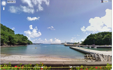
And across the other side of the world, you can view the Pacific Ocean from Japan’s Hahajima, one of the remote Ogasawara islands.

Haha-Jima, Japan

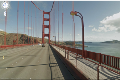
In addition, this latest batch of street-level imagery includes higher resolution panoramic views of places throughout the San Francisco Bay Area, Los Angeles and San Diego. This is great for both locals and potential visitors of these popular California destinations, who can now see even more realistic views of landmarks like the Golden Gate Bridge, Staples Center, and USS Midway.

Golden Gate Bridge, California

Of course, these are just a few of the many fascinating places in today’s release of new Street View imagery, so we encourage you to look around and virtually experience them for yourself right in Google Maps. Be it for armchair travel from the comfort of your computer, or to figure out where you might want to visit on your next vacation, we’re thrilled to continue our expansion of Street View.


Google Lat Long Blog: Street View: Our biggest update yet


Backlink: http://feedproxy.google.com/~r/blogspot/SbSV/~3/CT3veb0kzyU/street-view-our-biggest-update-yet.html

Wednesday, June 15, 2011

Google Lat Long Blog: My Places now helps you manage your important locations


Almost every day you encounter new places and businesses, whether it’s a new store you spotted on your commute to work, or a restaurant you visited with friends over the weekend. To date, you’ve been able to star places on Google Maps, rate them via Google Places, or add them to a customized map with your own icons and annotations through My Maps.

lue lisää


Google Lat Long Blog: My Places now helps you manage your important locations


Backlink: http://feedproxy.google.com/~r/blogspot/SbSV/~3/BqBp2dc0GW8/my-places-now-helps-you-manage-your.html

Friday, April 15, 2011

Google Lat Long Blog: An Update on Tags


[Cross-posted from the Google Small Business Blog]


As users increasingly rely on tools like Google Maps and Places for information about the world around them, we're working hard to develop products that help local businesses highlight themselves and their offerings.


Google Lat Long Blog: An Update on Tags


Backlink: http://feedproxy.google.com/~r/blogspot/SbSV/~3/lf05k1H0g2M/update-on-tags.html

Friday, April 8, 2011

Google Lat Long Blog: Hotpot is going Places


(Cross-posted from the Google Places Blog.)


Last November, we introduced Hotpot, our recommendation engine to help people discover great new places when they search on Google. It’s simple: Rate and review the places you know, add friends whose opinions you trust and we serve you up personalized recommendations based on those tastes.

lue lisää


Google Lat Long Blog: Hotpot is going Places


Backlink: http://feedproxy.google.com/~r/blogspot/SbSV/~3/RtTDKznHPEw/hotpot-is-going-places.html

Tuesday, April 5, 2011

Big Map Blog

Big Map Blog is, well, a new map blog. The curator explains the premise behind it: “there’s always been two things I wanted from a map blog, and rarely got: A.) enormous maps, and B.) access to the full-resolution file. That’s what this website is about. Enormous maps, file access, and if I can bang out a couple of paragraphs without sounding like an ass, then all the better.”

Big Map Blog first appeared on The Map Room: A Weblog About Maps on April 5, 2011. Copyright © 2011 Jonathan Crowe. Distributed under a Creative Commons licence.


Big Map Blog


Backlink: http://www.maproomblog.com/2011/04/big_map_blog.php

Saturday, March 26, 2011

Using Facebook to Grow Your Blog (Cincinnati Women Bloggers)

... Facebook Launches Facebook Places People who enjoy location based applications like Foursquare and Gowalla... Related posts brought to you by Yet Another Related Posts Plugin .

Source : Cincinnati Women Bloggers

Explore : Facebook, Social Network


Using Facebook to Grow Your Blog (Cincinnati Women Bloggers)


Backlink: http://wik.io/info/US/256048292

Saturday, March 12, 2011

Google Lat Long Blog: Post-earthquake images of Japan


In response to the devastating earthquake and subsequent tsunami that struck Japan, we’ve worked with our satellite imagery providers to get the latest available data of the areas affected most.

lue lisää


Google Lat Long Blog: Post-earthquake images of Japan


Backlink: http://feedproxy.google.com/~r/blogspot/SbSV/~3/Vp2Ng33ccAo/post-earthquake-images-of-japan.html

Monday, January 24, 2011

Google Lat Long Blog: Share your photos about Places


When looking for information about a place on Google Maps, I immediately look for photos to help decide if it’s the right place for the occasion I have in mind. Whether looking for images of a restaurant’s cuisine, or getting a feel for the ambiance at a local bookstore, photos immediately help me learn more about a place.


Google Lat Long Blog: Share your photos about Places


Backlink: http://feedproxy.google.com/~r/blogspot/SbSV/~3/zgT6bVOlPBs/share-your-photos-about-places.html

Sunday, January 16, 2011

Blog Fight Rules Of Engagement

Blog fights happen. Sometimes for attention, but most of the time because someone is really pissed off about something. And don't count out big media, they jump right in too when they feel it. No one's ever written down any rules for blog fights that I know of. But there are some unspoken rules and guidelines. Here are a few core strategies:

Blog Fight Rules Of Engagement


Backlink: http://feedproxy.google.com/~r/Techcrunch/~3/S3F1w6PkGsw/